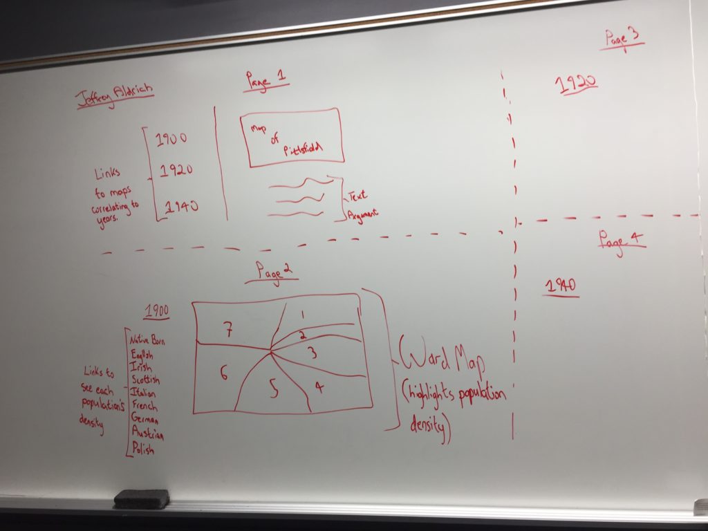
Wireframe: Pittsfield Census Records
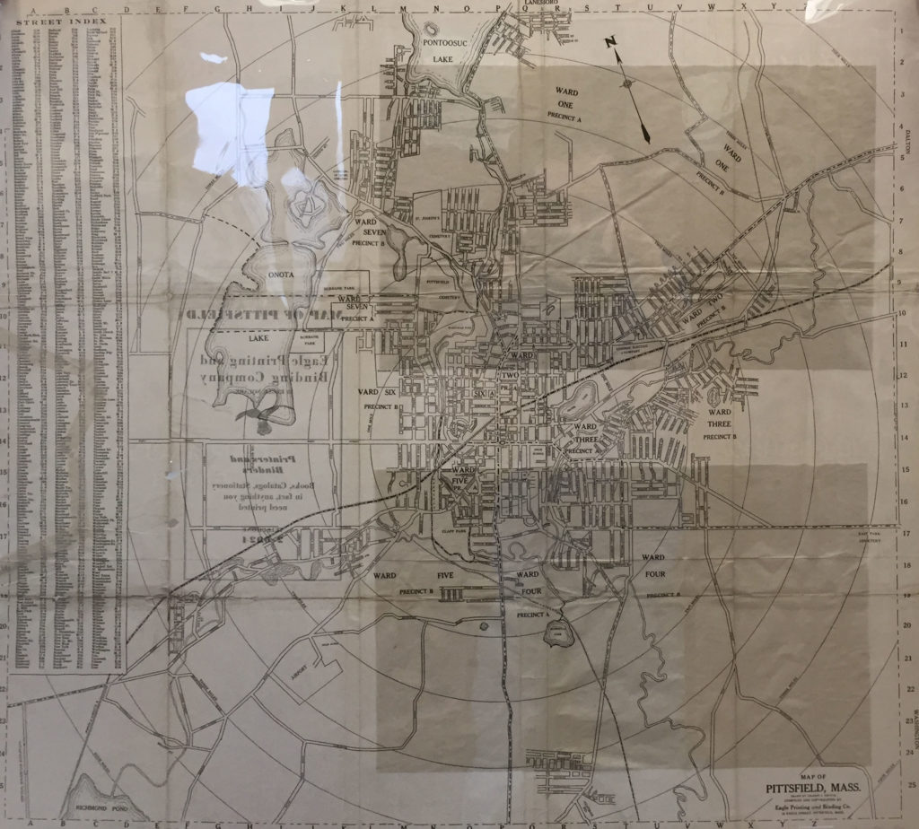
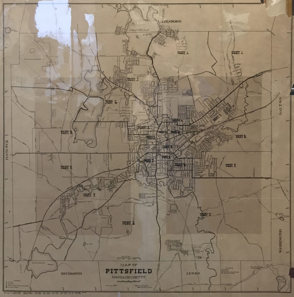
Argument: Language is an important component to cultural identity. Throughout the early twentieth century Pittsfield, Massachusetts was a culturally diverse city. Data provided from 1920 and 1940 city census records highlights how populations of U.S. natives and European immigrants from English speaking countries were evenly dispersed throughout each of Pittsfield’s seven wards. Contrary to this, European immigrants, and their children born in the United States, from non-English speaking countries tended to form micro-communities within a specific ward.
Underneath the main argument, visitors will find links to separate pages labeled “1920 Census Data,” “1940 Census Data,” “Further Information/Reading List,” and “Future Project Goals.”
Page Background Color: the background color of the site will be in light-beige. A light background color will make it easier to see the map of Pittsfield, and read the project argument.
Text Font and Color: The text will be in black and Amatic SC, a font found on Google Fonts.
1920 Census
This page will be accessed by clicking the “1920 Census Data” link found on the introduction page.
At the center of the page will be an interactive ward map of Pittsfield, Massachusetts from the 1920’s. Viewers will be able to select from different ethnic groups in order to see each groups population density within each ward, according to the 1920 census. These groups are as follows: natives, English, Irish, Scottish, French, Italian, German, Polish, and Austrian. There will also be available data selections highlighting the population of U.S. born children from each ethnic group.
This interactive map will be created by compiling data coordinates for the ward map using QGIS, inputting this data into Tableau, and integrating this data with ward population numbers of each group found on the 1920 census.
Page Background Color: The color will be light beige, matching the background color of the introduction page.
1940 Census
This page will be accessed by clicking the “1940 Census Data” link found on the introduction page.
The “1940 Census” page will match that of the “1920 census” page, but will, instead, incorporate information from the 1940 Census.
Page Background Color: The color will be light beige, matching the background color of the introduction page.
Further Information/Reading List
This page will be accessed by clicking the “Further Information/Reading List” link found on the introduction page.
The purpose of this page is to provide viewers with both academic texts on cultural identity and the importance of language, ethnic and racial distinctions of individuals and communities, and local, secondary sources from Pittsfield that discuss the diverse groups of people that have immigrated and lived in the city.
Page Background Color: The background color will be light beige.
Text Font and Color: The text will be in black and Slabo27 px, a font found on Google Fonts.
Future Project Goals
This page will be accessed by clicking the “Future Project Goals” link found on the introduction page.
This page will identify future goals of the project that will completed outside the parameters of the course Practicum In Digital History. These goals including:
- Incorporating all ethnic and racial groups living in Pittsfield into the analysis.
- Analyzing census data from years beyond 1920 and 1940.
- Identifying potential micro-communities of U.S. natives that immigrated into Pittsfield from different geographic areas within the United States.
Background and Text Font and Color: this will match the page “Further Information/Reading List”
Pages: 1 2
One Comment
Maeve Kane
What are you planning on doing with the Twine functionality? If you just need multiple pages, you’ll be better served by just doing WordPress pages or hand written pages. Twine is a framework for giving the reader a multiple choice path, which it doesn’t sound like you’re doing here. Twine is going to be a much bigger headache than necessary if you’re just using it to make multiple pages.
Is there going to be a place for viewers to compare the wardmaps across time? We had discussed side by side maps, is that no longer part of the plan?