Review: The Welikia Project
Beyond Mannahatta: The Welikia Project. https://welikia.org/. Created by Phillip Pond and maintained by the Mannahatta Project staff at the Wildlife Conservation Society, https://welikia.org/credits/. Reviewed February 3, 2019.
Welikia is Lenape for “my good home”, referring to the island of Mannahatta (Manhattan/Land of Many Hills). It is the center of Eric Sanderson’s project to remap Manhattan and reconnect it to its ecological roots. Reimaging the flora and fauna, recreating farms and habitations, he Welikia Project website aims to break down Sanderson’s project into easily understood, yet wholly fascinating parts.
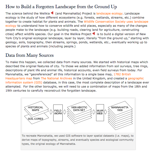
The Welikia Project has been in the works for over a decade. It is Eric Sanderson and his team’s attempt of showing what life was like at the time of Henry Hudson’s arrival and contrasting it with what we see now. Although it is not mentioned on the website, Sanderson questions whether or not a composite of the two periods might be our future. While the projects has hevy historic undertones, it centers on ecology, as Sanderson is a wildlife conservationist with a degree in ecology. The project itself does include bits of history, like the maps from Hudson and the American Revolution that served as a based layer for the project, as well as information on the Lenape, the original inhabitants of Manhattan. In addition to this, Sanderson used GIS to recreate topography other parts of the maps, ecological research to figure out the locations of streams and the different types of plants and animals in each place.
I firmly believe that pretty much anyone would think this website is cool and the projected visitors to the site are varied. Historians, wildlife conservationists, writers, teachers, students and New Yorkers are among the target audience for the site. All of these groups could benefit from the project depending on their own research and goals. There is a whole section devoted fro teaching this project in school. The subjects covered include biology, history, archaeology, and geography, all with their own pre-planned curriculum.
The Normal School Company page and Beyond Mannahatta are like two sides of a coin in terms of interaction. One of the coolest features on this site is a map that sections Manhattan into its blocks and allows you to see how that block’s landscape changed over the years (from 1609- now). The site also offers tables for the flora and fauna, a link to Sanderson’s 2009 TEDtalk on the project, curriculum, links to Lenape translations, as well as descriptions of the science behind the scenes.
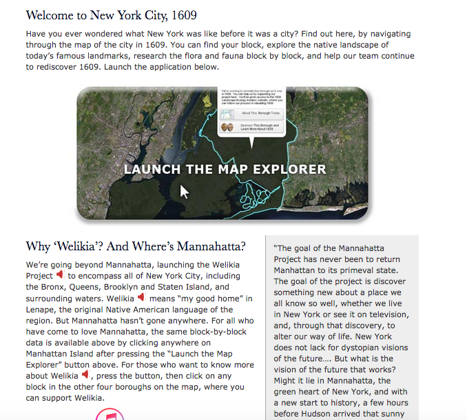
The interactive map would be impossible to replicate on paper as it requires the digital map to display the change. It also facilitates the process of looking up the location on the map. You can look one up or choose at random. The video, which deepened my understanding of the project and its importance, also could not have been written down on paper. By looking at the physical manifestation of Sanderson’s work, it was far easier to understand. Having the graphics to go with the geography and biology mad my life as a historian a lot easier. Not to mention that playing with the map was just plain fun.
One Comment
Maeve Kane
Do you think a project like this makes it easier to blend interdisciplinary work like ecology and environmental history?